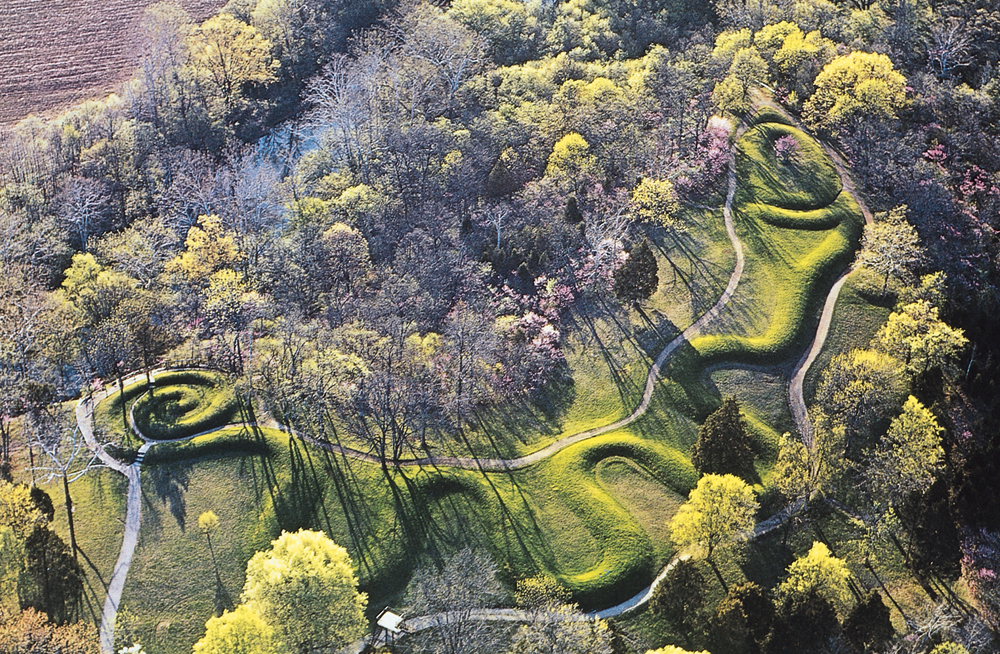
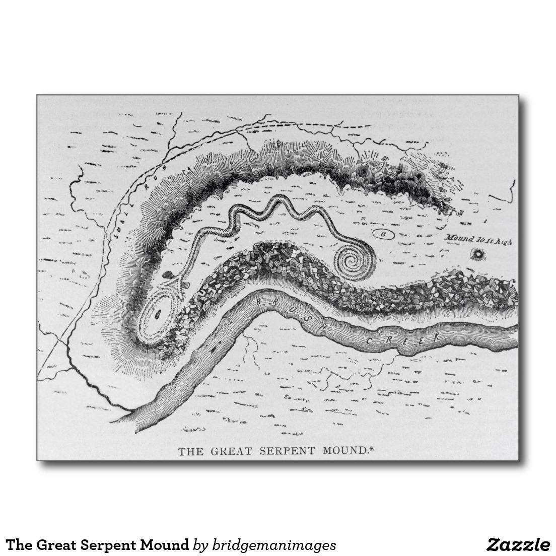
The Serpent Mound is an ancient U.S. archaeological site located in Adams County, Ohio and said to be constructed by the Adena tribe approximately 1,000 years ago. It is a 700 foot long mound in the shape of a serpent and is one of the last places in North America where you can still witness real life evidence left behind by the ancient people of North America.
The most fascinating fact about the Serpent Mound in Pleasant Hill is that it was built on a unique astrobleme site based on bedrock geology, planar deformed quartz, and shatter cones. This location, geologists from Ohio State government and the University of Glasgow (Scotland) have said was the result of a meteorite strike. It was built and sits near the crater’s southwest edge. Further analyses of the rock core samples indicated the meteorite impact occurred during the Permian Period, about 248 to 286 million years ago.
“I think we can say with authority today that this is an impact from a meteorite,” Mark T. Baranoski, a geologist with the Ohio Department of Natural Resources, told The Plain Dealer. “It affected the region in a spectacular way.”
Experts are unsure if the mound was used for religious purposes or to possibly mark the sacred location of the meteor strike.
The Serpent Mound extends about 1,370 feet (420 m) and varies in height from less than a foot to more than three feet (30–100 cm). Conforming to the curve of the land on which it rests, with its head approaching a cliff above a stream, the serpent winds back and forth for more than eight hundred feet and seven coils, and ends in a triple-coiled tail.
The serpent head has an open mouth extending around the east end of a 120-foot (37 m)-long hollow oval feature. Most of them are depicted with the snake eating an egg or with eggs in the general vicinity, though some scholars posit that the oval feature symbolizes the sun, the body of a frog, or merely the remnant of a platform.
From the Associated Press: “The object, if it did strike Ohio, would have been gigantic, possibly up to three times larger than the Cleveland Browns Stadium and traveling up to 45,000 mph. The heat, blast and shockwaves from such a crash would have carved a 1,000-foot-deep hole and crushed rocks miles below the five-mile across crater.
Researchers also have spotted microscopic cracks in quartz crystals far beneath the surface of the area and horsetail-shaped fractures called “shatter cones” in geological formations from the ground on down. The cracked crystals have patterns resembling those appearing after U.S. nuclear weapons tests in Nevada.
There are no other traces of a meteorite, but scientists say it would probably have vaporized when it hit 256 million years ago.
“I don’t think we’ll ever find it,” Baranoski said. “It would have gone up in smoke. If anything was left near the surface, it would have been eroded away.”
METEOR AND ROCK INFORMATION
“The geology at that location is complex, owing to the disturbance caused by the impactor. Detailed studies of the environmental mineralogy of the region are uncommon; such studies provide critical information for long-term archaeological site management and broader understanding of the geologic and environmental history of the region.”
“Rock samples were collected from an outcrop of impact breccia in the Silurian Tymochetee Formation northeast of the archaeological site. Those samples were analyzed using X-Ray Diffraction (XRD) and Scanning Electron Microscope (SEM). Results from the analysis indicate a wide range of minerals in the bedrock, composed of mostly dolomite (CaMg(CO3)2), some calcite (CaCO3), and a minor amount of other mineral phases such as oxide minerals, sulfides, and minerals minor rare earth element (REE) bearing minerals. Euhedral kaolinite crystals approximately 5 micrometers in diameter were also commonly observed. The SEM investigation indicated the dolomite crystals to be anhedral to euhedral and possessed variable twinning textures and pitting. Natural asphalt or tar occurred as tacky infilling that completely filled the pores, which were commonly 10 micrometers to 50 micrometers in diameter. Energy Dispersive Spectroscopy (EDS) analysis indicated an appreciable amount of sulfur in the asphalt or tar material.”
“This is the first detailed mineralogical investigation of bedrock at the Serpent Mound archaeological site using SEM. The occurrence of natural asphalt or tar along with information on mineralogical constraints will provide a detailed reference for future environmental impact studies, particularly relating to road traffic, rock face preservation and geoarchaeological investigations of sediment and soil tied to site use.” (MINERALOGICAL INVESTIGATIONS OF A METEORITE IMPACT BRECCIA FROM THE SERPENT MOUND ARCHAEOLOGICAL SITE, ADAMS COUNTY OHIO, see reference below).
“The Serpent Mound structure is an 8 km impact crater in southern Ohio. The impact occurred in and affected sedimentary target rock ranging from Cambrian to Silurian (and possibly strata as young as Mississippian) in age. Serpent Mound is a partially-preserved complex crater, with a central uplift, transition zone, and surrounding ring graben. Within the crater lies an anomalous gray, dolomitic polymict breccia with unique characteristics we informally refer to as the Serpent Mound Breccia (SMB). Originally, it was identified in a single (type) location in the western crater. The purpose of this study was to identify and map additional SMB locations and track its lateral distribution, which may allow us to identify a formation/emplacement mechanism.
Different breccia generation mechanisms result in a wide variation of lateral distributions. For the 3 most probable mechanisms for the SMB, faulting during rise/collapse of the central uplift, mass wasting from gravitational collapse, or ejecta fallback/resurge, expected distributions range from localized to crater-wide respectively. In order to track the lateral distribution of the SMB, we searched for new potential sites using aerial/satellite imagery, new field exposures, and references from former field investigations. Each potential breccia was compared to the SMB at its type location.
Upon positive identification, we mapped each new site and recorded elevations with GPS. GPS elevations and Brunton compass measurements allowed us to determine minimum apparent thicknesses of the SMB. Our team confirmed 8 new exposures in all but the eastern portions of the crater to date, with most of the sites located in the western half. Several other suspected sites are still under investigation. All confirmed and suspected sites lie in the transition zone within the crater.
The SMB ranged from 220-246 m above sea level and 3-21m in minimum apparent thickness at individual sites. The widespread distribution of the SMB within the crater does not support an origin by localized fault brecciation or single mass wasting events. It does support generation by a crater-wide geologic process following the impact event, with the most probable mechanism being fallback or resurge of ejecta. Ongoing work continues to address the viability of this hypothesis.”
Moe is the founder of GnosticWarrior.com. He is a father, husband, author, martial arts black belt, and an expert in Gnosticism, the occult, and esotericism.
 serpent and is one of the last places in North America where you can still witness real life evidence left behind by the ancient people of North America.
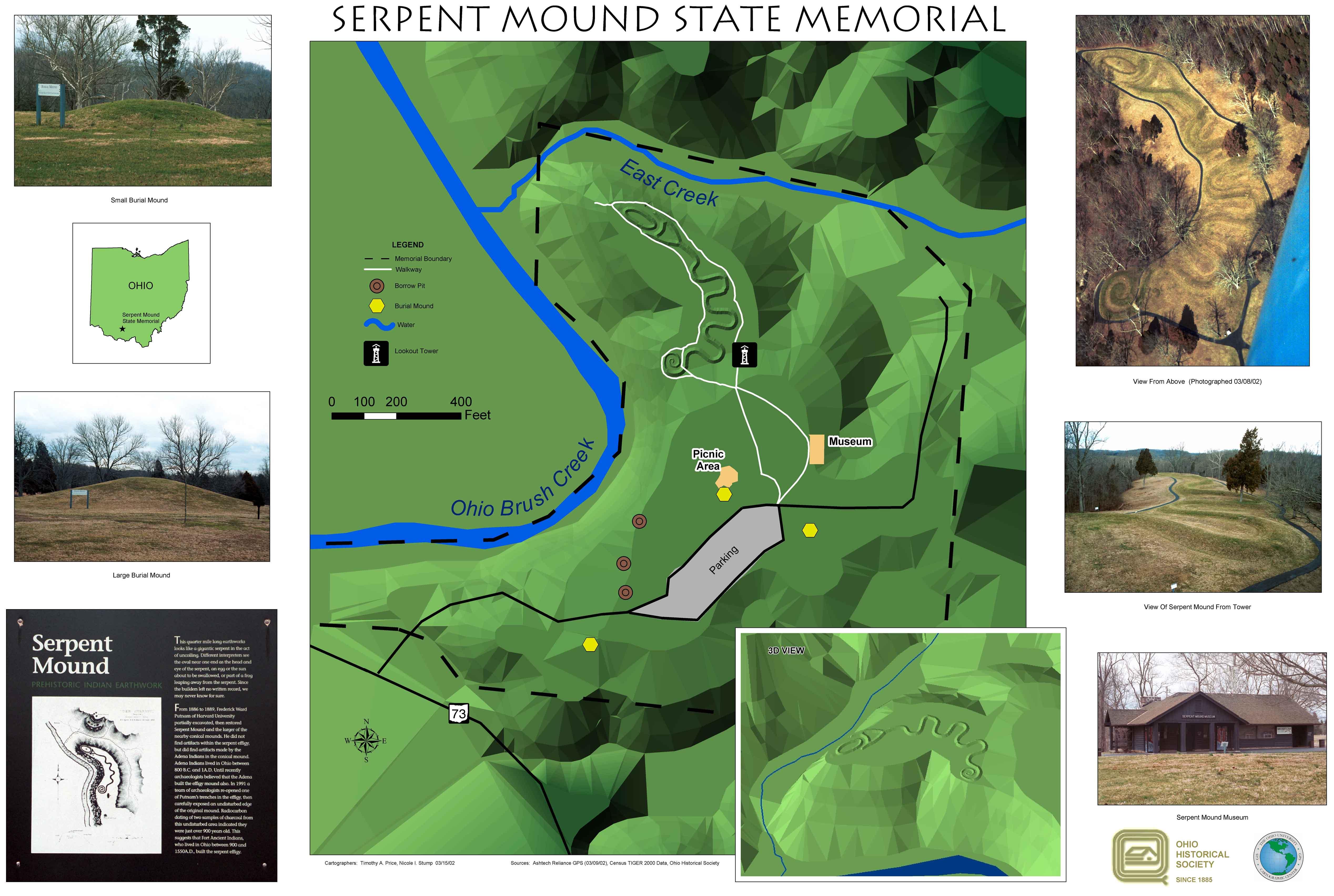


what is your understanding of the sophia
i really appreciate your knowledge and the taking time of doong all of this