NASA has reported recently on images taken of the Ceres dwarf planet from the Dawn Spacecraft where they found what appear to be a 3 mile high type pyramid or structure. In a statement NASA said, “Among the fascinating features on dwarf planet Ceres is an intriguing mountain protruding from a relatively smooth area. Scientists estimate that this structure rises about 3 miles (5 kilometers) above the surface. NASA’s Dawn spacecraft took this image from an altitude of 2,700 miles (4,400 kilometers). The image, with a resolution of 1,400 feet (410 meters) per pixel, was taken on June 6, 2015.”
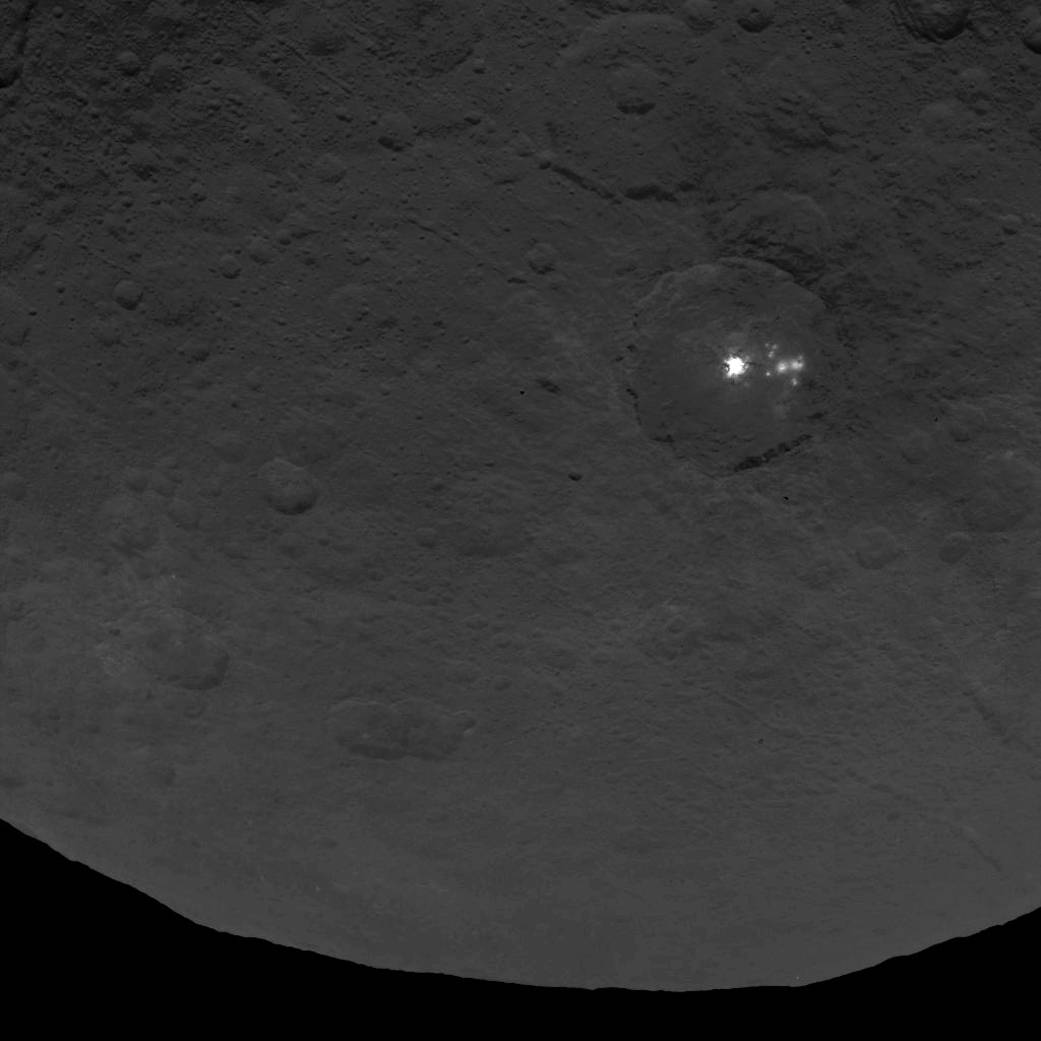
According to NASA, A cluster of mysterious bright spots on dwarf planet Ceres can be seen in this image, taken by NASA’s Dawn spacecraft from an altitude of 2,700 miles (4,400 kilometers). The image, with a resolution of 1,400 feet (410 meters) per pixel, was taken on June 9, 2015. The lead investigator for Dawn, Chris Russell of the University of California, Los Angeles said last week, “The bright spots in this configuration make Ceres unique from anything we’ve seen before in the solar system. The science team is working to understand their source.”
“The surface of Ceres has revealed many interesting and unique features. For example, icy moons in the outer solar system have craters with central pits, but on Ceres central pits in large craters are much more common. These and other features will allow us to understand the inner structure of Ceres that we cannot sense directly,” said Carol Raymond, deputy principal investigator for the Dawn mission, based at NASA’s Jet Propulsion Laboratory in Pasadena, California.
Here is a recent video below from NASA of a fly over the planet Ceres. NASA said about the video, “A new animated video of dwarf planet Ceres, based on images taken by NASA’s Dawn spacecraft, provides a unique perspective of this heavily cratered, mysterious world.
The video is based on observations of Ceres that were taken from Dawn’s first mapping orbit, at an altitude of 8,400 miles (13,600 kilometers), as well as the most recent navigational images taken from 3,200 miles (5,100 kilometers).
Data from 80 images are combined into the video. Analysis of overlapping images provided three-dimensional detail. The vertical dimension is exaggerated by a factor of two in the video.
“We used a three-dimensional terrain model that we had produced based on the images acquired so far,” said Dawn team member Ralf Jaumann of the German Aerospace Center (DLR), in Berlin. “They will become increasingly detailed as the mission progresses — with each additional orbit bringing us closer to the surface.”
Moe is the founder of GnosticWarrior.com. He is a father, husband, author, martial arts black belt, and an expert in Gnosticism, the occult, and esotericism.